
The Abridged version:
- The Upper Westside Specific Plan would add new neighborhoods outside of South Natomas with 2,000 acres of new homes, schools, storefronts, parks and open space.
- The Sacramento County Board of Supervisors is slated to vote on the project Tuesday afternoon.
- Last summer, the city of Sacramento voted 8-1 to formally oppose the project. The city has not agreed to the county’s proposal to use city water infrastructure for the project.
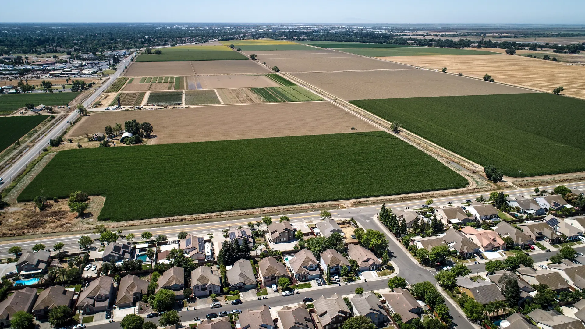
Thousands of homes may cover about 2,000 acres of land just outside of Natomas and Sacramento city limits, depending on whether Sacramento County supervisors approve a controversial housing plan.
The county supervisors are set Tuesday afternoon for a much-anticipated, and heavily debated, vote on the Upper West Side Specific Plan.
The project would make way for 9,350 housing units built gradually over the course of 20 years. Proponents have said the project could substantially add to the region’s housing supply. Others, including city of Sacramento leaders and environmental advocates, take issue with the scale of the development in the Natomas Basin and its proximity to sensitive habitat near the Sacramento River.
What’s the plan?
Developers describe the project as a “master-planned community” that could eventually house about 25,000 residents, similar to the population of Galt.
Designs show rows of single-family homes near new public parks and trails traversing the area, open space and drainage areas. Planners describe a “town center” that would include denser apartment buildings sitting atop ground-floor storefronts.
The plans also include up to three K-8 schools, a high school and a community college site.
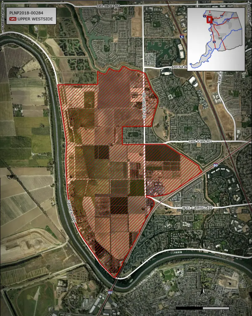
About three-quarters of the project site is currently used as farmland just outside of South Natomas. The proposed area is bounded by El Centro Road, Interstate 80 and Garden Highway. Maps also show a strip of buffer land between the east side of the Sacramento River and the west side of the development.
City and county at odds
City of Sacramento and Sacramento County elected officials have been locked in a heated debate over the project.
Last summer, the Sacramento City Council formally opposed the project with an 8-1 vote.
Much of the debate centers on an agreement from 2002 that set a cap on how much land could be developed in the Natomas Basin. The agreement allowed for 17,500 acres of development split between the city, Sutter County and acreage for the Metro Air Park project.
City staff previously wrote that the county “failed” to analyze the impact of developing projects outside of that 17,500-acre limit.
The city of Sacramento and environmental advocates raised concerns with potential encroachment into the 1-mile buffer adjacent to the Sacramento River that provides habitat for Swainson’s hawks and other species.
County staff have said the county began taking “a more active role in the urbanization discussions” at the request of residents and Natomas Basin landowners.
“Discussions with City of Sacramento staff have centered around their belief
that the jurisdictional roles outlined in the 2002 (agreement) remain applicable contrary to County staff’s perspective and a review of City decisions made by the City over the last 20 years,” reads a county staff report.
Proponents say the project could provide homes for up to 25,000 residents and help relieve the region’s housing crisis.
While the county has proposed connecting the project to water infrastructure owned by the city, Sacramento officials have not agreed to supply water to the area.
As an alternative, the county is also considering using water from the Natomas Mutual Water Company, which predominantly supplies water for agricultural uses.
Felicia Alvarez is a reporter at Abridged covering accountability. She’s called Sacramento home since 2015 and has reported on government, healthcare and breaking news topics for both local and national news outlets.