
The Abridged version:
- Local weather experts say El Niño tends to bring more sustained rain, increasing the chances of a wet winter for the valley and a snowy winter for the Sierra, but severity and duration are up in the air.
- Officials recommend residents and business owners have emergency plans in place in case of extensive flooding, such as planning escape routes and meet-up spots for family members if separated and obtaining flood insurance if they’re in flood prone areas.
- Sacramento’s flood risk is complex: the region sits at the confluence of two major rivers and relies on an interconnected system of levees, dams and bypasses to protect communities throughout the region.
It might be difficult to think about flooding while Sacramento temperatures are still hovering in the 90s, but the region’s rainy season is approaching, and with it, a familiar risk.
El Niño can increase the potential for a wetter winter, but it can’t predict exactly how the season will unfold. NOAA forecasts a more than 90% chance of a “very strong” El Niño this year, raising the risks of extreme weather.
But El Niño’s intensity and duration remain uncertain, leaving Sacramento to prepare for a range of possibilities in an area where flooding has long shaped the way communities manage water.
There are few urban flood control districts in the state like Sacramento’s, according to Tim Kerr, general manager at the American River Flood Control District that maintains 40 miles of levees along the American River and nearby creeks.
“Our levee districts protect highly urbanized population centers with lots of infrastructure,” Kerr said. “We’ve got a lot of features to protect and a lot of lives that our levees protect.”
Most levee districts are rural and protect agricultural land, he said.
“When people have a six-foot-tall levee, that tells you that you need the levee to be that high or else it would probably be six feet deep everywhere. In Sacramento, we have levees that are 20 to 25 feet.”
What the experts are saying
El Niño winters haven’t followed a predictable script in Sacramento.
Having reported on several El Niño events since 1991, former KCRA Chief Meteorologist Mark Finan said the climate pattern is an important clue about the months ahead, but not a guarantee of what’s to come.
Finan said the event tends to bring more sustained rain, increasing the chances of a wet winter for the valley and a snowy winter for the Sierra, but it’s still unclear how strong El Niño will become.
He’s seen El Niño years that left minor damage and neutral or La Niña years that resulted in devastating flooding. He said the area consistently has above average precipitation and is at risk of flooding in any given year, so residents should always be prepared.
“If you look back at any major flood events in California, there have been about 10 or 12 of them, and only two of them were in El Niño years,” Finan said.
The 2016-2017 water year, for example, wasn’t an El Niño year. It was considered a weak La Niña, meaning it was expected to bring drier and warmer conditions. Yet it was Sacramento’s second-wettest water year since 1950, with nearly 34 inches of precipitation. January and February alone brought the city almost a year’s worth of rain.
Nicholas Pinter, a UC Davis professor in the Department of Earth and Planetary Sciences and Associate Director of Davis’s Center for Watershed Sciences, said it’s still a matter of probability at this stage.
“El Niño means that the equatorial eastern Pacific is really warm; it’s disrupting and changing circulation patterns. However, it isn’t a strong predictor of what Sacramento will see this winter,” he said.
Pinter explained California has a complex flood protection system built over the last century, and it counts on the stability of levees, dams and reservoirs like the Yolo Bypass. The system has done well for many decades, but officials and residents should always be vigilant, Pinter said.
“Portions of the Sacramento area are at grave risk should the levee system fail, which would be extremely rare but an extremely catastrophic event,” Pinter said.
He said it’s the long-term investment in maintenance of our levee systems that has the main influence on what we’re going to be saying at the end of this winter.
Flood risk runs deep
Flooding has long been part of the city’s history, considering it was repeated floods that forced Sacramento to build upward, outward and around the water, eventually creating the extensive levee and bypass system in place today.
Kerr said the district is constantly working to keep the levees in like-new condition through operations and maintenance. In heavier storms, crews patrol the levees 24 hours a day looking for defects and signs of stress.
“We treat every single year as if it’s going to be the big one,” Kerr said.
Sacramento County spokesperson Matt Robinson said the county’s preparation begins when the last storm season ends. Starting around March and April, the county works to clear debris and overgrowth from culverts and ensure drainage systems in unincorporated areas work properly.
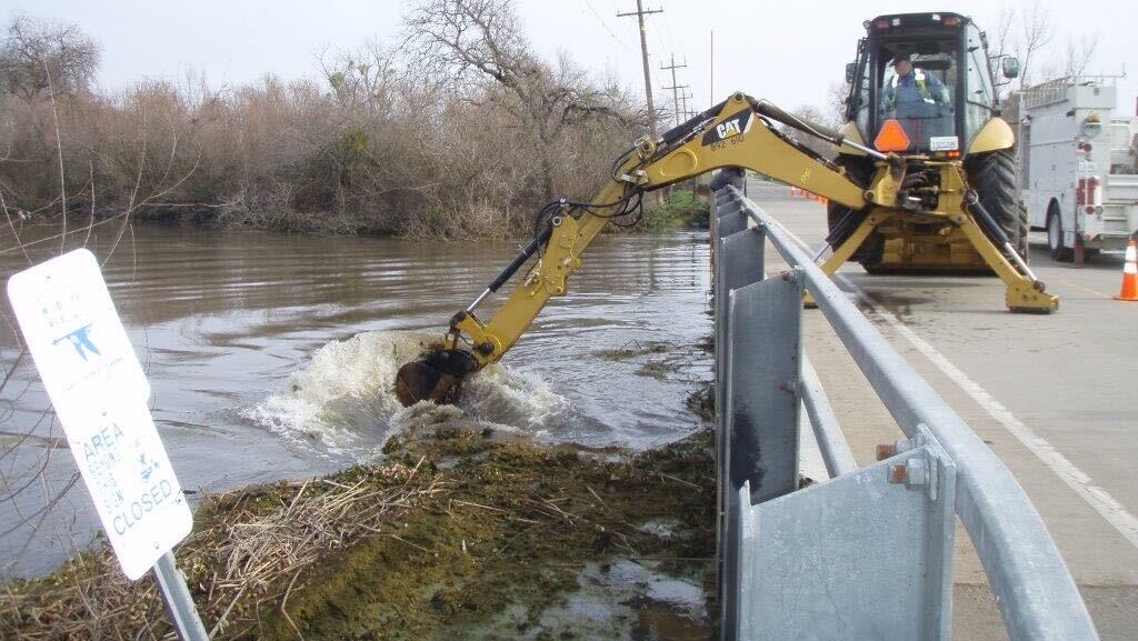
“The Department of Water Resources in the county oversees about 1,444 miles of concrete and lined culverts for the water to go through,” Robinson said. “That’s about from here to Colorado Springs, Colorado, so we handle a lot of territory when it comes to making sure that the water has somewhere to go.”
Each year in September, the department sends flood-risk notices to property owners in the 17 counties in the Levee Flood Protection Zone to inform them of their risk and remind them to be prepared.
According to the department, 47 out of 58 California counties declared a state of emergency due to 2023 flooding, and at least 28 people died due to storms and flooding that year; many from attempting to drive through flooded roadways.
“We always tell people turn around, don’t drown, because you don’t know how deep it is,” Robinson said. “While you think you may be able to drive your car in there, you can’t see what’s on the road.”
The city of Sacramento says that while less than 25% of residents live within a special flood hazard area, any property in the area is at risk of flooding because of the city’s heavy reliance on its levees, which can be damaged in extreme weather.
Robinson said most homeowners’ insurance doesn’t cover water damage, so taking out a separate flood policy can be a good move for residents living in vulnerable areas. Pinter explained that only a small percentage of Californians have flood insurance, but it’s a worthwhile investment considering the region’s ongoing risk.
“People forget during the dry years that this is an option and a way for a property owner in or out of the mapped flood plain to protect themselves against the worst-case scenario this winter,” Pinter said.
Residents can use this FEMA tool for a quote on flood insurance. Robinson pointed out that there’s a 30-day waiting period for policies to become active.
How to prepare
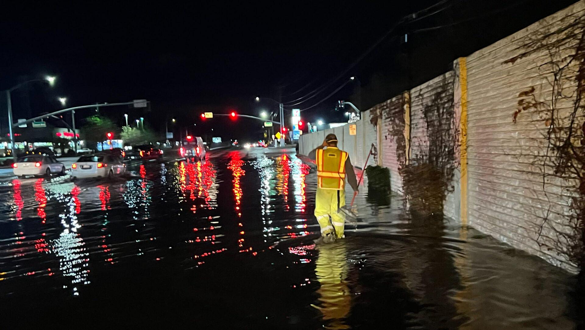
While Sacramento’s larger water sources like the American River can be influenced by heavy rainfall, Robinson said it’s the smaller water sources that can flood quickly and unexpectedly.
“A lot of times it’s the little, smaller creeks and streams that residents live by because those are the areas where if you have a lot of rain in a short amount of time, will flood quickly,” he said.
Robinson advised residents to have an emergency plan in place in case their family is separated to make sure they can meet up if their homes are flooded. Residents can also keep up with live water levels on the county’s ALERT page.
“It’s a way for the public to know if things are starting to get a little dicey in their neighborhoods,” he said.
Residents can check their flood risk on the department’s website and call 311 to report flooding.
Every November, Sacramento County opens free, self-service sandbag sites for residents to help them protect their homes from flooding. Site locations and opening dates will be posted on the county’s website as they’re announced. A shovel is the only thing residents need to bring.
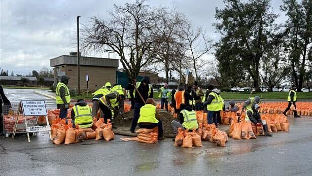
“When we have storms, we have all hands on deck 24 hours a day to make sure we can respond to those calls,” Robinson said. “We just need assistance in the eyes of the public to tell us where it’s happening.”
Robinson said crews are sent out to clear storm drains as calls come in, and if their elbow grease doesn’t work, they use a vacuum truck to suck out all the debris. He asked residents to do their part by clearing the drains in front of their home before rainfall.
“If they clear the system in front of their homes and businesses before the storms hit, it really reduces the work that staff has to do which frees them up for bigger calls,” Robinson said.
Annie Biebl attends Sacramento State and is an intern at Abridged.