
The Abridged version:
- Water levels at most reservoirs that serve the Sacramento region are at more than 100% their historic averages. Local rivers are also running high.
- At the same time, Friday’s survey of conditions in the Sierra Nevada revealed that the snowpack is below average for March.
- Despite the recent storms, flooding is not currently posing a major concern for local communities.
It’s a tale of two realities when it comes to water in the Sacramento region this year.
Local rivers are swelling and reservoirs are well above their historic averages after a recent influx of rain. At the same time, snowpack levels in the Sierra Nevada are slimmer than last year, which could pose challenges later into summer and fall.
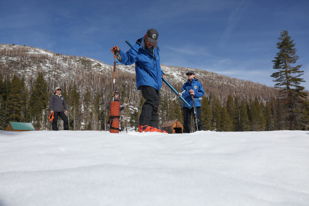
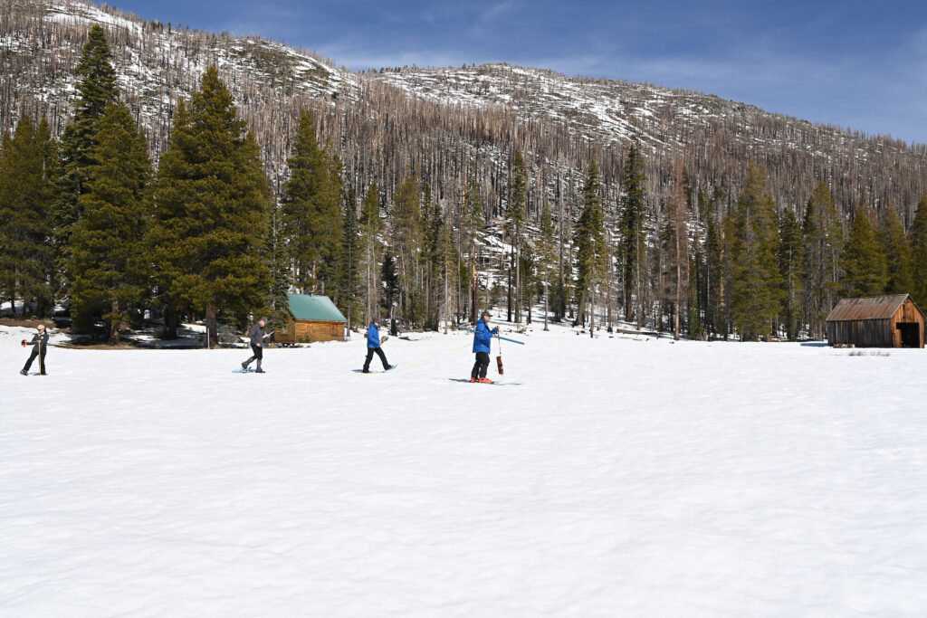
On Friday morning, state authorities conducted their March snow survey at Phillips Station in El Dorado County, about 3 miles west of Echo Summit.
It revealed that the snowpack is just 47% of its historic average. Snow in the mountains often acts as a “natural reservoir” for much of the state, fueling water infrastructure in the valleys below.
The monthly measurements provide clues for predicting water deliveries later in the year. So far, the prediction for water deliveries to users is grim. Federal officials say only 15% of expected deliveries will be possible, while the State Water Project pegged its estimate at 30%.
“Despite the high snow totals delivered by the February storms, we are below average, and nowhere near we would like to be at this time of year,” said Andy Reising, manager of snow surveys and forecasting at the California Department of Water Resources.
Hard for snowpack to catch up
Between recent warmer storms that hit the snowpack and dry conditions that are predicted for the next couple weeks, state authorities aren’t sounding optimistic.
“It’s going to be really hard to catch up,” Reising said, at a press conference.
The snowpack in the central Sierra Nevada, the mountains closest to the Sacramento region, is faring better than up north. That portion of the snowpack is at 70% of its historic average, Friday’s snow survey found.
Water arrives in the valley
All the signs of a well-watered winter are beginning to arrive across the Sacramento region.
Water is rising underneath the Yolo Bypass, as the river reached heights that allow it to spill over the Fremont Weir on Friday morning.
Rivers are looking flush, with both the American River and Sacramento River predicted to soon rise about 5 feet and reach their highest crests yet for the season, according to the National Weather Service.
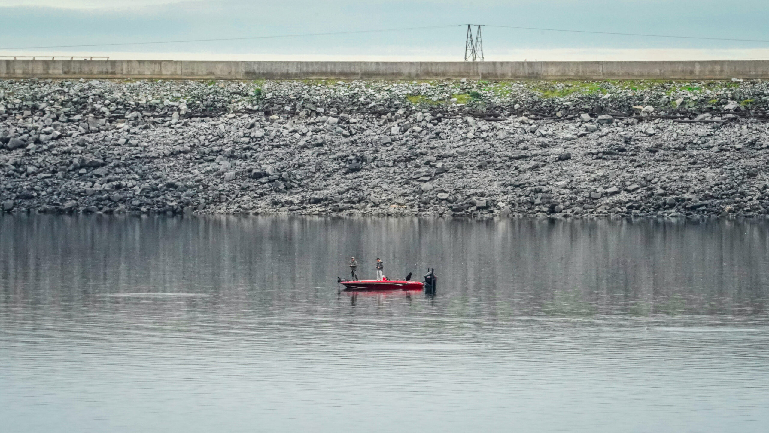
And, Folsom Lake is beginning to fill, with the dam’s spillway shedding water at a modest rate with an uptick expected in the coming days.
Recent downpours have also put most of the region’s water supplies at, or above, 100% of historic averages, according to the state’s water watch monitors.
Above average rain but low flood threats
“This year has been shaping up to be a pretty decent year in terms of precipitation,” said Sean deGuzman, flood operations manager at the Department of Water Resources. “In general we’re sitting just above average.”
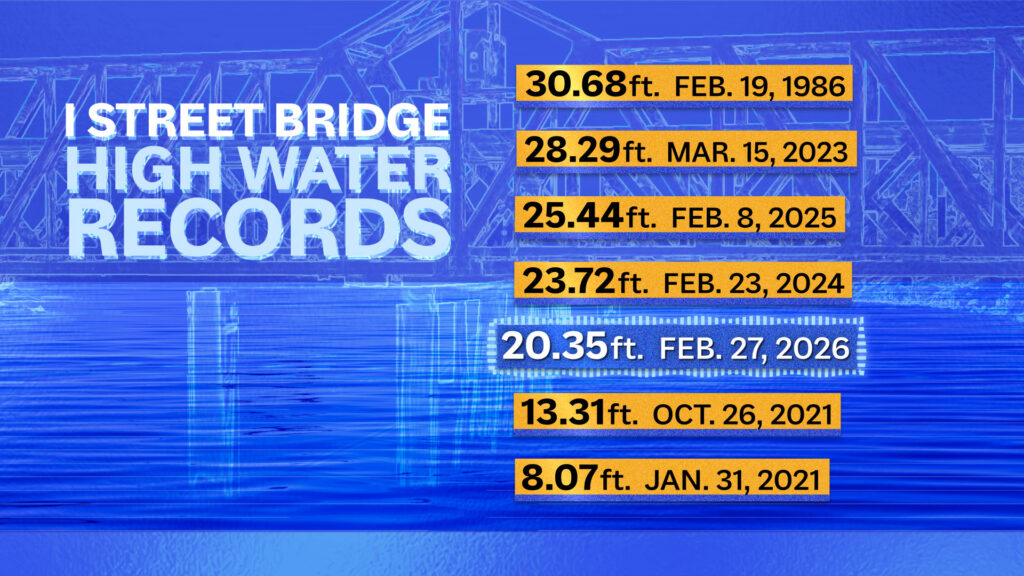
The part of the Sacramento River that flows through Downtown Sacramento near the I street Bridge is expected to soon reach about 22 feet. The area is one location that officials look to as an indicator for flood risk. That level is far lower than the historic flood threats of the 1980s and ’90s, however.
Sign Up for the Morning Newsletter
The Abridged morning newsletter lands in your inbox every weekday morning with the latest news from the Sacramento region.
Flood mitigation warnings begin at 27.5 feet, and “minor flooding” warnings arrive if the water hits 33.5 feet, according to the National Oceanic and Atmospheric Administration. The highest crest recorded on that stretch of the river is 30.68 feet in 1986. The peak seen in recent years was 25.44 feet in February 2025.
Region has history of flooding
After a relatively dry January, the steady, but not too heavy, rains this month have been a welcome change for those who follow water.
“We have full-ish reservoirs, and now some snowpack to work with. … It’s now a matter of looking forward to flood risk,” said Nicholas Pinter, a geomorphology professor at UC Davis.
Pinter said that the Sacramento region’s Mediterranean climate often “flip-flops” between too much and too little rain. While the current conditions are a positive, “anything can happen moving forward,” he said.
“We have a long history of damaging and even catastrophic flooding that no one should forget,” Pinter said.
In terms of flooding, the Sacramento region appears to be in the clear, for now. If heavy rains or atmospheric river conditions return, however, locals should remain on alert, Pinter said.
Looking for ‘happy and full’ reservoirs
Flood managers like deGuzman are looking for reservoir levels to fill adequately, but enough that there can still be room for water storage in case a heavy storm hits.
“The goal is to have happy and full reservoirs” by the time summer comes around, deGuzman said.
“As of right now there isn’t any type of concern and we’re not forecasting anything to reach that action monitor stage,” deGuzman said, referring to flooding in the region.
Folsom Lake is currently at 120% of its historic average for late February, leaving the reservoir at about 59% of its total capacity, according to DWR.
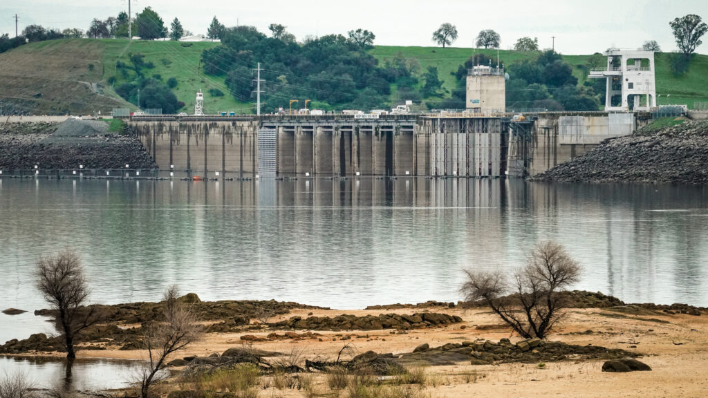
Folsom Dam is visible across Folsom Lake from Beales Point on Feb. 26, 2026. (Martin Christian)
Berryessa, Oroville exceed averages
Lake Berryessa is now at 116% of its historic average for this time of year.
The famed Morning Glory Spillway, more commonly known as the “Glory Hole” at Lake Berryessa, is on the cusp of coming to life this year. If the water level rises to 440 feet, the spillway will activate. As of Friday morning the water level was at 438.82 feet, according to the Solano County Water Agency.
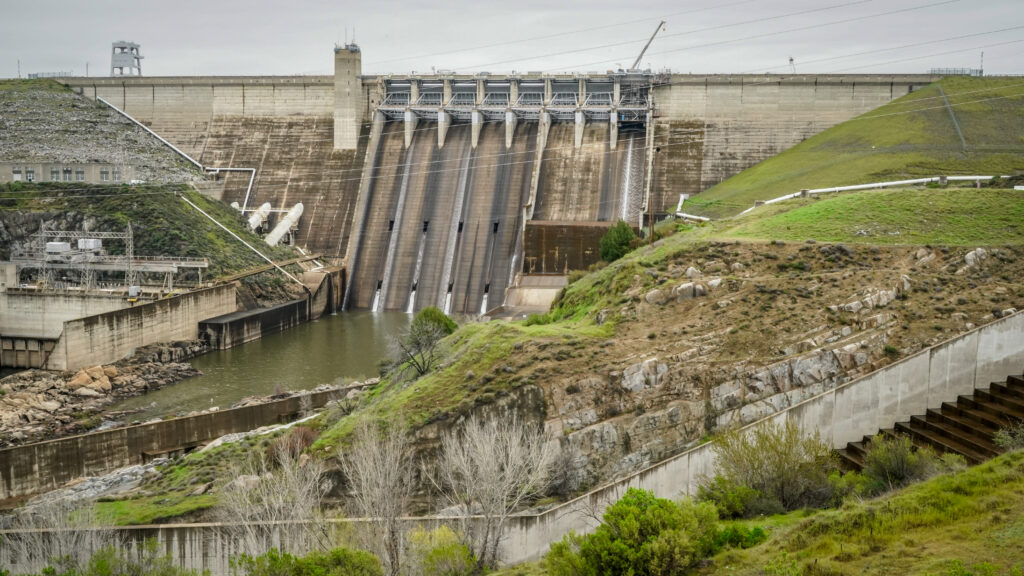
Lake Oroville is at 126% of its historic average. The reservoir, which is the second-largest in California, provides a substantial amount of water for agriculture and local cities and communities connected to the State Water Project.
Sacramento readies for ‘bathtub effect’
Between the levees that block out flooding from the rivers and low elevation across the city, heavy rainfall doesn’t always have somewhere to go.
“It’s almost like pouring rain over a bathtub,” said Carlos Eliason, spokesperson for the city of Sacramento, who focuses on utilities and flood control.
The city of Sacramento helps oversee a series of manual pumps to keep water from pooling too much due to the “bathtub effect.” The system has been built to withstand the type of continuous, light rain, that the region has seen in recent weeks, he said.
“The light rain will tend to soak into the ground. … Our systems won’t get overwhelmed,” he said.
The city does monitor its “usual suspects” though, where flooding is common. Parts of Robla may get closed off and some parks may see localized flooding, Eliason said.
Flood-prone county on alert
Flood-prone parts of unincorporated Sacramento County are also preparing for an uptick in water levels. As of Friday, no areas in the county were experiencing flooding, according to the county’s flood monitor dashboard.
“This year has been rather normal,” said county spokesperson Matthew Robinson.
However, creeks and streams are beginning to fill, and the Consumnes River hit its monitor level a couple times in February. Flood concerns rise when the snowpack gets hit by warmer rainstorms that can melt it too early, Robinson said.
When that happens, some parts of the county will see flooding so severe that “if you have a 2-liter (bottle) of water and pour it onto the road, it will flood,” Robinson said. So far this year, however, those conditions are not materializing, he said.
Felicia Alvarez is a reporter at Abridged covering accountability. She’s called Sacramento home since 2015 and has reported on government, health care and breaking news topics for both local and national news outlets.