

The Abridged version:
- The U.S. Army Corps of Engineers has tentatively selected a plan to widen the Yolo Bypass in eastern Yolo County.
- If completed, the project would inundate roughly 1,200 acres of prime farmland in the Upper Elkhorn Basin.
- The move would place more flood infrastructure in Yolo County to protect populated areas in the Sacramento region.
Every few minutes, an airplane flies over the Upper Elkhorn Basin, reminding those who live and work there that changes are coming.
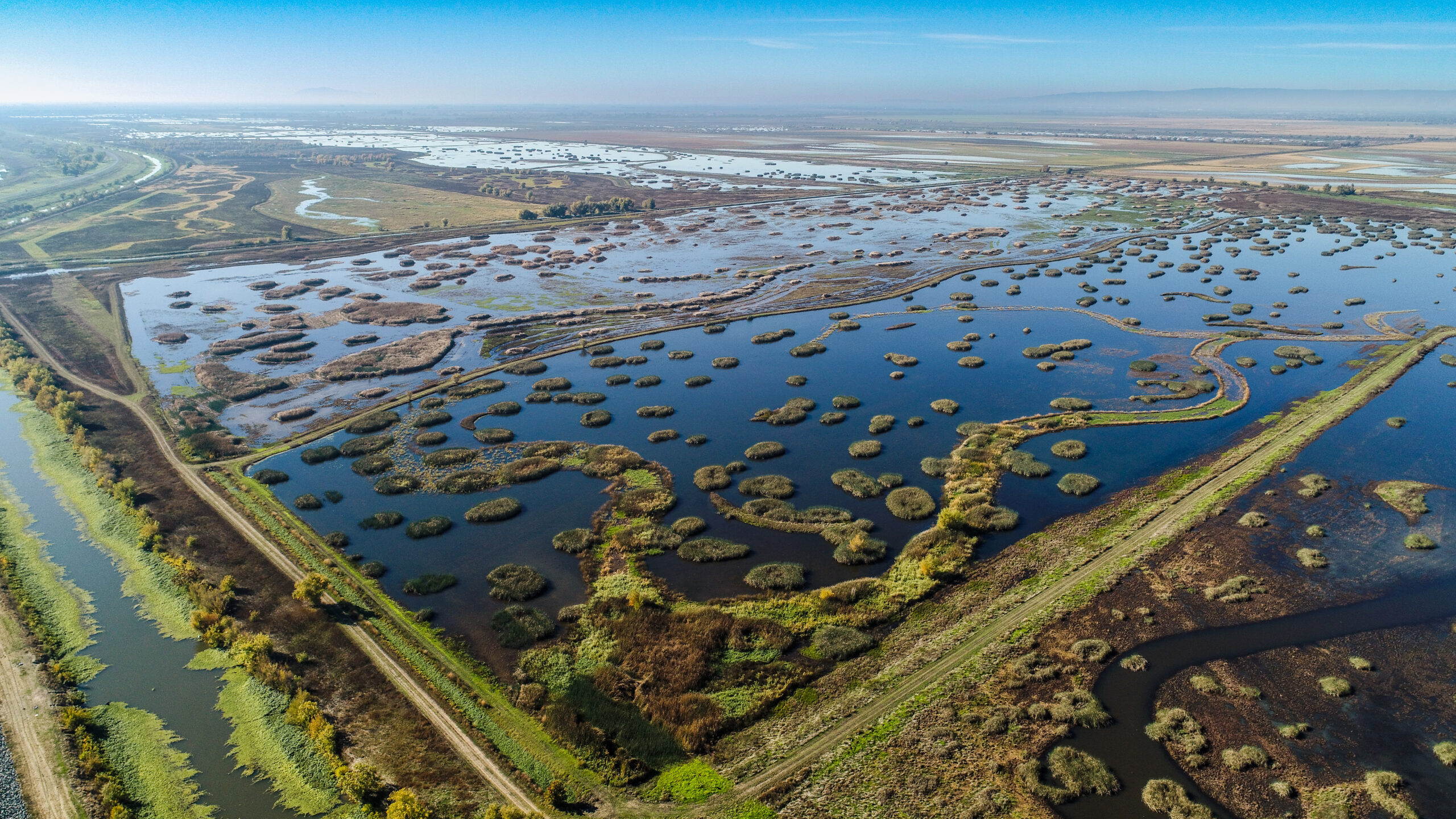
Bounded on the east by the Sacramento River and the west by the Yolo Bypass, the quiet, agricultural stretch of Yolo County has been farmed for more than a century. From atop its levees, the view stretches out over miles of mature trees, newly planted orchards and tomato fields.
But as climate change and development along the eastern edge of the river increases flooding risk for thousands of residents in the Sacramento region, state and federal water managers are eyeing the Upper Elkhorn Basin as a potential solution.
To protect vulnerable points along the river, including the airport and other parts of the Natomas Basin, the U.S. Army Corps of Engineers recently released a tentative plan to widen the Yolo Bypass into the Elkhorn Basin. The move would inundate roughly 1,200 acres of prime farmland, fundamentally altering how the land would be used.
“It’s a significant amount for the people that live and work out there,” said Michele Clark, president of Reclamation District 1600, which drains the land in the Upper Elkhorn Basin to make it farmable. “There’s expected anxiety over changing the landscape that’s going to affect people’s livelihoods.”
Sign Up for the Yolo County Newsletter
Stay in-the-know on all things Yolo! Weekly email with stories and insights from Yolo County reporter Daniel Hennessy.
Widening the bypass
The Yolo Bypass has long been a bulwark of California’s flood control system. During the rainy season, a series of weirs along the Sacramento River guide roughly 80% of floodwater into the bypass, where it circumnavigates nearly a million people on its way to the Delta.
That has worked for decades, but officials said less predictable weather patterns and more intense storms have increased risk in the already flood-prone Sacramento region.
To address that problem, the Army Corps of Engineers and state partners embarked on the Yolo Bypass Comprehensive Study after authorization from Congress in 2020. The study evaluates the capability of the bypass, meant to identify ways to meet increasing demand on the flood management system.
After considering multiple options, the Army Corps of Engineers tentatively selected a plan at the end of August that would widen the Fremont Weir by a mile and bisect the Upper Elkhorn Basin with a setback levee to hold the floodwater. The roughly $560 million project would transform 1,200 acres of permanent prime farmland into bypass.
“What was farmed today, will then be flooded,” Clark said.
The project still has years of hoops to jump through, but the selection of a plan moves officials closer to breaking ground. Construction could begin as soon as 2033, and all the infrastructure and affected lands will be in Yolo County, while most of the flood-risk benefit will be felt in the Sacramento area.
“All of the impact, particularly the agricultural, and I would like to add in here somewhere economic, is 100% on Yolo and all of the economic advantage and the flood protection advantage is someplace else,” said Supervisor Sheila Allen during a September meeting.
Changes to prime farmland
While some parts of the current bypass are cultivated, farmers are limited to crops that are seasonal and can be harvested before the rain starts in the fall. Right now, there are acres and acres of permanent tree crops in areas of the Upper Elkhorn Basin that could eventually be flooded in the winter.
Because of that, the federal government will need to compensate landowners for the land they are giving up.
Those negotiations have not started, but Clark said that farmers usually end up receiving a lump sum payment for land that was making them money each year. Replacing the lost farmland is not easily accomplished.
“There isn’t just farmland lying around that nobody is farming,” she said. “If they lose that, they may not be economically viable.”
In addition, Reclamation District 1600, whose primary function is to maintain a system of aging pumps and infrastructure to drain the land of excess water for farming purposes, will lose assessment income from the lost acreage, putting it in a more precarious financial situation.
While the project’s current iteration affects less land than a previous one proposed by the state, Clark said it will still have a meaningful effect.
“It’s still 1,400 acres that will be converted from farmland to non-farmland,” she said.
One of a handful of projects
The expansion of the bypass is not the only water management project happening in Yolo County. Because of its geography, river frontage and land use practices that prioritized farmland and open space, the county is one of the focal points of the state’s infrastructure.
Regional, state and federal efforts in Yolo County include the widening of the Sacramento Weir, the Fair Ranch project, the Bay Delta Plan and the Delta Conveyance Project, among others.
At the Board of Supervisors meeting Sept. 9, county counsel Phil Pogledich said the county needs to push for local connection and benefits for these projects.
“Envision that these projects are like federal highway projects that go through Yolo County,” he said. Without off-ramps in the area, all the benefits go elsewhere.
The comment period for the bypass expansion project is open until Friday, Sept. 18. After that, officials will evaluate the plan again and move forward with the process.
In the meantime, farmers in the Upper Elkhorn Basin continue to work the land, having gotten used to the sound of airplanes passing overhead.